|
|
|
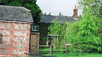
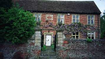
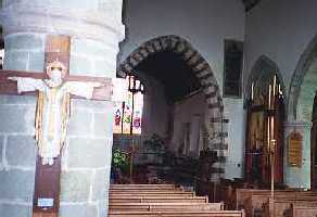
There is also a Newton Cottage of 16th century vintage less than 100 yards from the farmhouse, though now separated by the A36 highway, which bisects the original farm). John and Suzi Lanham, the proprietors of the farmhouse, took great interest in my quest, and were most gracious in their hospitality, showing me around the house and passing on their knowledge of history in the area.
Newton Farmhouse itself is a place of unusual charm. The
16th-century house has been lovingly restored by the Lanhams to
something
like its 19th-century character (albeit with the amenities needed for a
modern B&B), with original flagstone floor and brick fireplace with
bread oven in the current dining room. After the death of Lord
Nelson
at Trafalgar, his family was given a lot of farmland in this
area—including
Newton Farm—so the Lanhams have made the dining room a sort of Nelson
shrine.
(There is a mansion not far away called New House, built by Judge
Jeffries,
the “hanging judge” of the Dorchester Assizes [passed a pub named for
him
in Dorchester a couple of days later] and the current owners are a
Jeffries—the
house has never left the family—who is married to a descendant of Lord
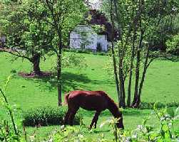
Nelson’s sister.) There is also a lovely back garden—Suzi had
just
been gathering greens up a garden path when I first arrived—and Suzi
Lanham
is an exceptional cook and bread-maker.
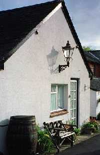 |
The charming little outbuilding in the back garden, where I stayed. |
Thursday morning before breakfast I made the 10-minute walk up
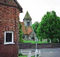
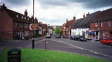
the narrow lane to Whiteparish. The town’s main street is called
simply “The Street,”
 |
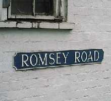 |
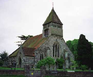
and just by the parish church for which the town is named (and which presumably stood at the end of town originally), this becomes Romsey Road (Romsey being a town about 10 miles southeast), the “Rumsey Lane” mentioned in the 1625 will.
Since the property named there had fourteen lodgings ("lugge")
facing
onto the road, and this property in turn was previously connected to
the
main family farm; since these lodgings could only have been on the
south
(and church) side of the road because the village green is on the north
side; since they might plausibly have stretched from the churchyard to
a public footpath to the east which lies between a flint-and-brick barn
of some age and the Parish Lantern Inn (footpaths and inn locations are
often ancient); and since this would have been consistent with having
near
“neighbors” at Newton Farm and Moor Farm and a general orientation
toward
the mill-and-transport town of Downton to the west; the “Bushy Lease”
forming
the Rolfe family farm can be reasonably located on the map as part or
all
of the land between the village green and the village common, or
roughly
the current site occupied by Common Farm.
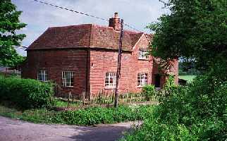
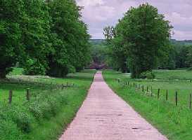
 Common Farm |
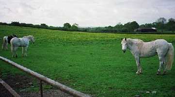 The farm west of it, near Newton |
(The Common, now a forested park, stands some distance from the village and would, I think, have been farmland shared by all, either as open pasture or in strips for crops. The Green, by some latter-day blunder now covered with modern houses, is just outside the original village, and would have been a recreational gathering place.)
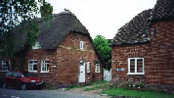
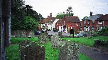
The principal building material in Whiteparish is red brick and
flint.
Most of the town is relatively modern and not uniform, but it is
modestly
attractive, with a few structures dating from the 17th century or
earlier.
The church is stone and flint, which must originally have given it a
very white appearance (the town was first called “White Church”),
though
why that would have been remarkable among many similar churches in the
area is hard to say.
 |
 |
 |
Flint was readily available—essentially for free—and extremely durable, so building costs could be reduced by interspersing brick or stone work with a square of plaster and chunks of flint.
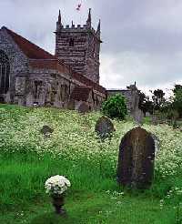
There are Rolfes buried in the churchyard, but English weather
has a very short memory, and even most 19th century gravestones here
are
illegible.
Across Romsey Road from the church are the White Hart Inn on one side of the cross street and Wisteria Cottage on the other—both buildings which might have been standing in 1625.
I have completed my description of Whiteparish here, though I
did not complete these observations and photographs until my second
visit
the following morning. Returning now to Thursday morning, I set
out
after breakfast for Downton.
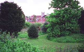
The old road from Whiteparish to Downton is the same one that leads to Newton Farm (the name of the farm suggesting that its founder thought himself sufficiently removed from Whiteparish to start a “new town”) and Moor Farm (“”Mort” either in origin or by misspelling in 1625), the holdings of John Rolfe’s friendly neighbors. One more village (Redlynch, now quite built up) intervenes, but Downton (about 4 miles from Whiteparish) would have been a farmer’s destination on this route, since it bestrides the Avon roughly midway between Salisbury and the sea, and would have been necessary both for milling and for shipping. (This is not the same Avon as in Stratford, by the way, but the southern branch of Bath’s Avon, which empties into the sea at Christchurch, near Bournemouth.)
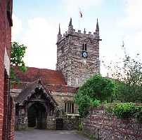
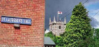
Downton goes all the way
back to Saxon times, established because a
hill ( = “dun,” hence Dun-town) near a fording place in the river made
for a logical fortification. The Church of St. Laurence was
consecrated
in 638, only about forty years after Christianity arrived in
England.
I’m not sure when the current building was built, but it was certainly
there in 1625, and it was in this churchyard that John Rolfe was
buried.
Again, of course, the gravestones are quite thoroughly erased.
 |
 |
 |
 Someone remembers who's under this stone! |
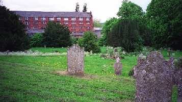
The red brick building in the background of the picture above is a tannery with a working water wheel; weirs were built here at some point in history to harness the river for industry.
On the hill for which the town is named is “The Moot,” a
motte-and-bailey
(i.e. ring-works) type fortress. A castle was built on this site
in the early 12th century, to protect the fording place of the main
road
from London to the west, by the Bishop of Winchester, brother to King
Stephen.
The Bishops of Winchester (the same office, incidentally, which
controlled
and set standards for the entire prostitution industry in London, where
the whores were known as "Winchester Geese") owned much of the town,
and
kept a palace there, until they were stripped of it by the Commonwealth
in the 1640’s. The Rolfes, in fact, came to America at about the
time of the English Civil War, but since they came to Massachusetts
they
were probably not royalists. [Actually I have no hint so far as
to
why the family, or part of the family, would leave this land—I need to
do more checking on the general history of the area.] Anyway,
there
were many royal visits to Downton between the 12th and 14th
centuries.
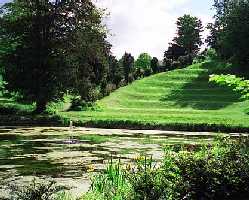
The current Moot House (center, below) was built in 1690, and in that
age
of peace and prosperity the old fortification (on the hillside,
stretching
from the front of the house to the river) was converted to a pleasure
garden,
and this garden has recently been restored as a nice public park.
 |
 |
 |
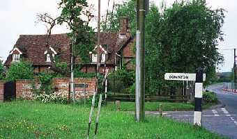
North of Downton stands Barford Farm—or “Bereford Farm,” as it
is known in both the 1625 will and several public records I saw quoted
in the Downton Library. According to the account I was reading,
the
old farmhouse was taken down after a fire in 1815, leaving only its
“fine
avenue of trees leading from Barford Farm to Alderbury Road.”
(I drove out to take this picture, but would guess that some of the trees from the “fine avenue” have been lost to disease since the account was written.) In any event, William Stockman (named in the will) was born there in 1540, was MP for the Borough in 1603, and died in 1626. The Library account interestingly notes that part of the funding in his will came from “a farm in Whiteparish,” and according to John Rolfe’s will Stockman was the Rolfes’ landlord there.
The will identifies another piece of land leased from Stockman, with
great specificity: “the three acres of ground sometimes waste
ground
parcel of the Earldome lying between Langley wood and the round
coppice.”
On the Ordnance Survey map there is just one strip of land this could
refer
to, between Langley Wood and what is now called Shearwood Copse (copse
and coppice are the same word). I set off to eat a picnic lunch
on
this land my ancestors had farmed, starting my hike at Gill’s Hole on
the
Whiteparish-Downton road, just southeast of Titchborne Farm on the OS
Map,
at the bend in the road.
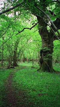
To anyone repeating this experience, I strongly recommend entering
Langley
Wood at the other end of the trail instead, on the road northeast of
Lover;
the stables at Gill’s Hole make initial access to the trail very muddy
and difficult. I was fortunate to be met by the owner of the
house
there, who warned me of all the difficulty but encouraged me to
“persevere”
as the trail beyond was beautiful—and he was quite right. Soon
enough
I was on a gorgeous woodland walk, far removed from any human sound,
with
birds singing and bluebells, herb robert, mouse-ears, and ferns all
around
in old marshland. The trail runs for a time beside either a dry
streambed
or an old road with typical English banks thrown up on either side, but
long abandoned. My guess is the latter, though the land is very
low
here and as a road it would have flooded often (which might be why it
was
abandoned). When the trail switches back to the southwest it
seems
to follow this “road,” now quite dry with a drainage ditch beside
it.
In a novel such as Pillars of the Earth you read about medieval
travelers going on foot through deep forest from one town to the next,
and this walk reminded me very much of how I imagined that.
 |
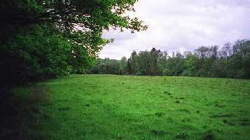 |
Before long, the three-acre field came up on my right and I walked
into
the middle of its grassy rectangle. (In the picture above, the
“round
coppice” on the northwest corner of the field can be seen in the
righthand
distance.) As I did so, a large herd of deer (at least 30) slowly
raised their heads from what must have been a relatively sound sleep in
the warm afternoon sun, then very slowly got to their feet and after
staring
at me for a few moments (I wasn’t very close), moved off into the
wood.
I inferred that humans were not everyday company there. On the
other
hand, the deer were presumably kept by Hamptworth Lodge (current owner
of all this land) for occasional shooting, as I saw two blinds built
along
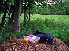
the edge of the woods on the north side. I sat down to eat my
lunch
on a hay-bale near one of these, looking out on the field farmed by
John
Rolfe and his heirs, almost 400 years ago.
Cutting back across the field I roused two splendid pheasants, then resumed my lovely woodland walk out to the public road. From start to end of the hike I had not seen another human being.
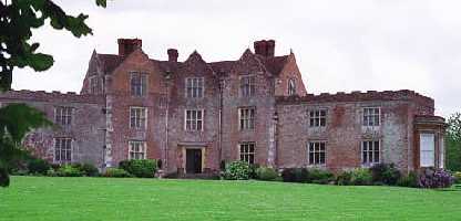
I extended my hike to take in the village of Lover (pronounced,
alas,
low-ver) where I was rewarded (perhaps appropriate to the name?) by
hearing
the song of the cuckoo for the first and only time during my entire
month
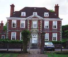
in England. I also walked through the grounds of New House
(below;
as noted above, the seat of the Jeffries family) on the way back to my
car.
My sense of the land in the Whiteparish-Downton area is that at least 90 per cent of what was farm or forest in the seventeenth century still is; there was no “sprawl,” or suburban development. On the other hand, I do not recall seeing a single tilled field; the farm land I saw was either woods or pasture. This made me wonder if there was some deficiency in the soil that made more “complete” farming untenable.
After some more time in Downton at the Library I drove into Salisbury for what turned out to be a rather futile stop at the library there, but a nice walk around one of my favorite cities. Then back to Newton Farmhouse where I met John Lanham for the first time (he had been away on business until then) and received a grand tour of the entire premises, after which John and Suzi entertained me with a splendid dinner and conversation to the end of the day.